How hurricanes (tropical cyclones) form. NASA.
 Tropical cyclones are like giant engines that use warm, moist air as fuel. That is why they form only over warm ocean waters near the equator. The warm, moist air over the ocean rises upward from near the surface. Because this air moves up and away from the surface, there is less air left near the surface. Another way to say the same thing is that the warm air rises, causing an area of lower air pressure below.
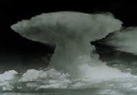
A cumulonimbus cloud. A tropical cyclone has so many of these, they form huge, circular bands.
Air from surrounding areas with higher air pressure pushes in to the low pressure area. Then that "new" air becomes warm and moist and rises, too. As the warm air continues to rise, the surrounding air swirls in to take its place. As the warmed, moist air rises and cools off, the water in the air forms clouds. The whole system of clouds and wind spins and grows, fed by the ocean's heat and water evaporating from the surface.
Storms that form north of the equator spin counterclockwise. Storms south of the equator spin clockwise. This difference is because of Earth's rotation on its axis.
As the storm system rotates faster and faster, an eye forms in the center. It is very calm and clear in the eye, with very low air pressure. Higher pressure air from above flows down into the eye.
Rotation wind speed is due to the planet spinning - Coriolis Force - from friction between surface and air; and to the rate of heat rising (and sucking in cooler air). The Earth spins at about 1,000 miles an hour (1,600 kph); so in theory it can impart very high speeds depending on the friction. Average calculations for planet Earth show that the two effects, (a) spin and (b) rising air can create winds of 100 metres per second or 224 mph.
ACT OF GOD SHUTS TAX-HAVENS
 Tropical cyclones are like giant engines that use warm, moist air as fuel. That is why they form only over warm ocean waters near the equator. The warm, moist air over the ocean rises upward from near the surface. Because this air moves up and away from the surface, there is less air left near the surface. Another way to say the same thing is that the warm air rises, causing an area of lower air pressure below.
A cumulonimbus cloud. A tropical cyclone has so many of these, they form huge, circular bands.
Air from surrounding areas with higher air pressure pushes in to the low pressure area. Then that "new" air becomes warm and moist and rises, too. As the warm air continues to rise, the surrounding air swirls in to take its place. As the warmed, moist air rises and cools off, the water in the air forms clouds. The whole system of clouds and wind spins and grows, fed by the ocean's heat and water evaporating from the surface.
As the storm system rotates faster and faster, an eye forms in the center. It is very calm and clear in the eye, with very low air pressure. Higher pressure air from above flows down into the eye.
 |
| Trump's $50 M mansion on St Martin island |
As these Caribbean islands, hiding an estimated $32 trillion in illicit tax-unpaid assets, are wrecked by Hurricane Irma, and the hurricanes still to come - who will pay for rescues and restorations? The Tax-Evaders? The islanders? or OECD Tax-payers via the World Bank? The frozen assets have been siphoned from the US, EU, UK, Pacific Rim and other wealthy regions. Do tax-dodgers Sir Richard Branson and President Donald Trump and the rest of them now need our mainland ships, planes, medics, personnel and a big tax-payer handout to rebuild their off-shore mansions?
"I'm Smart. I don't pay tax" President Trump during his campaign; still refusing today to show his tax-returns.
CNN: Hurricane IRMA
Irma's core, with maximum sustained winds of 185 mph -- well above the 157 mph threshold of a Category 5 -- slammed Barbuda early Wednesday before hitting St. Martin and Anguilla.
Virginia Barreras told CNN she was riding out the storm in a hotel in tiny St. Martin, an island of about 75,000 people.
"The palm trees are bent over and (I) can't see anything but white," she said early Wednesday, before Irma's core passed over the island. "The walls shake when the wind blows hard, and we can hear debris being thrown around.
The Category 5 hurricane is "potentially catastrophic," the National Hurricane Center said. Besides devastating winds, the center warns of high storm surges that could crush low-lying structures near shore.
Though Irma's path is uncertain, forecasters have said it could turn toward Florida over the weekend, and officials there are ordering some evacuations and shutting down schools.
Latest developments
-- Around 8 a.m. ET Wednesday, Irma's core was spinning about 15 miles west-southwest of Anguilla, with maximum sustained winds of 185 mph.
-- After slamming St. Martin and Anguilla and St. Kitts and Nevis in the morning, the storm is expected to be near the British Virgin Islands and northern US Virgin Islands.
-- The storm's center is then expected to pass near or just north of Puerto Rico on Wednesday afternoon or night.
-- Irma is likely to turn toward the Turks and Caicos islands and the southeastern Bahamas, where storm surges of up to 20 feet are possible, the hurricane center said.
-- It's too early to tell whether it will make landfall on the US mainland, but forecasts show it could churn toward Florida over the weekend.
-- People in Florida should heed any evacuation order, Gov. Rick Scott said Wednesday. "(A) storm surge could cover your house. We can rebuild homes -- we cannot rebuild your family," he said.
-- In the US Virgin Islands, Gov. Kenneth E. Mapp ordered a 36-hour curfew that started at 6 a.m. local time Wednesday.
No comments:
Post a Comment